Black Rock Forest


Park Overview:
Linked to Storm King State Park by the Stillman Trail, Black Rock Forest is the largest area in the Highlands with a sustained elevation over 1,200 feet. Here the mountains plunge for more than 1,000 feet to the west, north and south, providing the hiker with sweeping vistas and strongly contrasting habitats.
Park Description:
Black Rock Forest has served as a field station for scientific research and education for more than seven decades. The forest was originally set aside in 1918 by Dr. Ernest Stillman for experimentation in forest management and for demonstration of forestry methods. The forest is now administered by the Black Rock Forest Consortium, a group of public and private educational and research institutions whose mission is to promote scientific research and excellence in education while carefully managing the ecosystem of the forest. Several scientific studies are in progress at any given time, and thousands of students visit the forest each year for a variety of educational programs. Less than a mile into the Forest, the Science Center, Forest Lodge, and Pavilion afford spectacular views; all use green building techniques and serve as models for sustainable design principles and technologies, with award-winning environmental features. They are open to the public, but no exhibits are provided. Despite this primary educational emphasis, the Consortium is dedicated to keeping Black Rock Forest open to the public for recreational pursuits such as hiking.
Black Rock Forest's cultural history dates from about the time of the American Revolution. The Continental Army used Continental Road, which bisects the forest, as a route across the mountains from West Point to New Windsor and Newburgh. From Spy Rock, sentinels from Washington's camp at Newburgh monitored British vessels sailing up the Hudson from Haverstraw Bay.
The forest represents a characteristic slice of New York's Hudson Highlands. Botanists have described a number of distinctly different ecological zones and it also contains numerous ponds and reservoirs, which supply local communities with water and the hiker with refreshing vistas.
To hike in Black Rock Forest, organized groups should contact the Forest in advance. There is no entry to Black Rock Forest during deer-rifle season.
Trails Overview:
There are 23 blazed trails within the forest, in addition to numerous woods roads which can be used to form interesting loop hikes.
These include the Duggan Trail (0.4 mile, red) which provides the primary access to the Black Rock Forest trail system from the main parking area. The Mine Hill Trail (0.2 mile, yellow diamond) provides access to Black Rock Forest from the west. Parking for the Mine Hill Trail is available for five cars just above the steep hairpin turn on Mine Hill Road, 0.9 mile from Angola Road near Mountainville. The western end of the aptly named Scenic Trail (5.9 miles, white) is just south of the northern junction of Mineral Spring and Old Mineral Spring roads near Mountainville. Parking is available 0.3 mile farther south, at the southern end of Old Mineral Spring Road. The Scenic Trail traverses many of the most interesting features of the park and ends at a junction with the Stillman Trail (yellow). From the gate across Reservoir Road, opposite the main parking area and a short distance from Storm King State Park, the Black Rock Forest section of the Stillman Trail (5.3 miles, yellow) heads east, following a footpath into the woods. At 2.8 miles, it crosses the summit of Black Rock Mountain and after passing many other features, terminates at a viewpoint overlooking Mountainville. The Highlands Trail (teal diamond) is co-aligned with the Stillman Trail (yellow), the Compartment Trail (blue) and Scenic Trail (white).
Use the Web Map link on this site for a trail map provided by the Black Rock Forest Consortium.
Park Acreage:
3850.00 acresMunicipality:
CornwallLinked to Storm King State Park by the Stillman Trail, Black Rock Forest is the largest area in the Highlands with a sustained elevation over 1,200 feet. Here the mountains plunge for more than 1,000 feet to the west, north and south, providing the hiker with sweeping vistas and strongly contrasting habitats.
Black Rock Forest has served as a field station for scientific research and education for more than seven decades. The forest was originally set aside in 1918 by Dr. Ernest Stillman for experimentation in forest management and for demonstration of forestry methods. The forest is now administered by the Black Rock Forest Consortium, a group of public and private educational and research...
Park Acreage:
3850.00 acresMunicipality:
CornwallContact Information
Web Link:
Black Rock Forest ConsortiumPhone:
(845) 534-4517Fees:
NoneDogs in park:
Dogs on leash
Hike Checklist:
Whether you are going for a day hike or backpacking overnight, it is good practice to carry what we call The Hiking Essentials. These essentials will help you enjoy your outing more and will provide basic safety gear if needed. There may also be more essentials, depending on the season and your needs.
The Essentials
Hiking Shoes or Boots
Water - Two quarts per person is recommended in every season. Keep in mind that fluid loss is heightened in winter as well as summer. Don't put yourself in the position of having to end your hike early because you have run out of water.
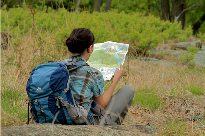
Map - Know where you are and where you are going. Many of our hiking areas feature interconnecting network of trails. Use a waterproof/tear-resistant Tyvek Trail Conference map if available or enclose your map in a Ziplock plastic bag. If you have a mobile device, download Avenza’s free PDF Maps app and grab some GPS-enhanced Trail Conference maps (a backup Tyvek or paper version of the map is good to have just in case your batteries die or you don't have service). Check out some map-reading basics here.
Food - Snacks/lunch will keep you going as you burn energy walking or climbing. Nuts, seeds, and chocolate are favorites on the trail.
Sunscreen and insect repellent
Rain Gear and Extra Clothing - Rain happens. So does cold. Be prepared for changing weather. Avoid cotton--it traps water against your skin and is slow to dry. If you are wearing wet cotton and must return to your starting point, you risk getting chills that may lead to a dangerous hypothermia. Choose synthetic shirts, sweaters and/or vests and dress in layers for easy on and off.
Compass - A simple compass is all you need to orient you and your map to magnetic north.
Light - A flashlight or small, lightweight headlamp will be welcome gear if you find yourself still on the trail when darkness falls. Check the batteries before you start out and have extras in your pack.
First Aid Kit - Keep it simple, compact, and weatherproof. Know how to use the basic components.
Firestarter and Matches - In an emergency, you may need to keep yourself or someone else warm until help arrives. A firestarter (this could be as simple as leftover birthday candles that are kept inside a waterproof container) and matches (again, make sure to keep them in a waterproof container) could save a life.
Knife or Multi-tool - You may need to cut a piece of moleskin to put over a blister, repair a piece of broken equipment, or solve some other unexpected problem.
Emergency Numbers - Know the emergency numbers for the area you're going to and realize that in many locations--especially mountainous ones, your phone will not get reception.
Common Sense - Pay attention to your environment, your energy, and the condition of your companions. Has the weather turned rainy? Is daylight fading? Did you drink all your water? Did your companion fail to bring rain gear? Are you getting tired? Keep in mind that until you turn around you are (typically) only half-way to completing your hike--you must still get back to where you started from! (Exceptions are loop hikes.)
Check the weather forecast before you head out. Know the rules and regulations of the area.
The Leave No Trace Seven Principles
Plan Ahead and Prepare
- Know the regulations and special concerns for the area you'll visit.
- Prepare for extreme weather, hazards, and emergencies.
- Schedule your trip to avoid times of high use.
- Visit in small groups when possible. Consider splitting larger groups into smaller groups.
- Repackage food to minimize waste.
- Use a map and compass to eliminate the use of marking paint, rock cairns or flagging.
Travel and Camp on Durable Surfaces
- Durable surfaces include established trails and campsites, rock, gravel, dry grasses or snow.
- Protect riparian areas by camping at least 200 feet from lakes and streams.
- Good campsites are found, not made. Altering a site is not necessary.
- In popular areas:
- Concentrate use on existing trails and campsites.
- Walk single file in the middle of the trail, even when wet or muddy.
- Keep campsites small. Focus activity in areas where vegetation is absent.
- In pristine areas:
- Disperse use to prevent the creation of campsites and trails.
- Avoid places where impacts are just beginning.
- Pack it in, pack it out. Inspect your campsite and rest areas for trash or spilled foods. Pack out all trash, leftover food and litter.
- Deposit solid human waste in catholes dug 6 to 8 inches deep, at least 200 feet from water, camp and trails. Cover and disguise the cathole when finished.
- Pack out toilet paper and hygiene products.
- To wash yourself or your dishes, carry water 200 feet away from streams or lakes and use small amounts of biodegradable soap. Scatter strained dishwater.
- Preserve the past: examine, but do not touch cultural or historic structures and artifacts.
- Leave rocks, plants and other natural objects as you find them.
- Avoid introducing or transporting non-native species.
- Do not build structures, furniture, or dig trenches.
- Campfires can cause lasting impacts to the backcountry. Use a lightweight stove for cooking and enjoy a candle lantern for light.
- Where fires are permitted, use established fire rings, fire pans, or mound fires.
- Keep fires small. Only use sticks from the ground that can be broken by hand.
- Burn all wood and coals to ash, put out campfires completely, then scatter cool ashes.
- Observe wildlife from a distance. Do not follow or approach them.
- Never feed animals. Feeding wildlife damages their health, alters natural behaviors, and exposes them to predators and other dangers.
- Protect wildlife and your food by storing rations and trash securely.
- Control pets at all times, or leave them at home.
- Avoid wildlife during sensitive times: mating, nesting, raising young, or winter.
Be Considerate of Other Visitors
- Respect other visitors and protect the quality of their experience.
- Be courteous. Yield to other users on the trail.
- Step to the downhill side of the trail when encountering pack stock.
- Take breaks and camp away from trails and other visitors.
- Let nature's sounds prevail. Avoid loud voices and noises.
The Trail Conference is a 2015 Leave No Trace partner.
(c) Leave No Trace Center for Outdoor Ethics: www.LNT.org.
Directions to Trailhead :
65 Reservoir Road, Cornwall, NY 12518
The main parking area is 0.2 mile south of US 9W on the northern side of the forest (GPS Coordinates: 41.418798, -74.010291)
Coming from the south, drivers take the first right turn onto Mountain Road, 0.4 mile after the parking area on US 9W. A sharp right leads through a very narrow one-lane tunnel under the highway. (The tunnel is passable by small vehicles only; larger vehicles should proceed as below.) The road passes a T-intersection and continues to the main parking area. Larger vehicles, or those that miss the Mountain Road turnoff, can proceed north on US 9W to the Angola Road exit to the southbound lanes of US 9W and proceed as described below.
For visitors coming from the north on US 9W, the entrance to the forest is 1.5 miles south of Angola Road. A right turn onto Reservoir Road and another right turn at the T junction in 0.3 mile leads to the main parking area. Limited parking is available at other forest entrances, with the largest area immediately adjacent to US 9W, south of Old West Point Road. There is also limited parking on the west side as noted in the trail descriptions.
Public Transportation: Coach USA bus service to within two miles of the forest is available from New York City's Port Authority terminal to Mountainville (on the west side of the forest) or to Cornwall-on-Hudson (on the north side).
TRAIN TRANSPORT :
Not availableBUS TRANSPORT :
Public Transportation: Coach USA bus service to within two miles of the forest is available from New York City's Port Authority Bus Terminal to Mountainville (on the west side of the forest) or to Cornwall-on-Hudson (on the north side).
Share Your Experience
 Support the trails with a donation!
This privately owned forest closes to all hikers during the hunting season.