Edwin B. Forsythe National Wildlife Refuge


Park Overview:
The refuge’s multiple locations on one of the Atlantic Flyway’s most active paths make it an important link in the network of national wildlife refuges.
Park Description:
Following the pattern of a flat rock thrown across a body of water, the Edwin B. Forsythe National Refuge skips nearly fifty miles up the New Jersey shoreline jumping from Oceanville, north to Holgate, Manahawkin, Forked River and finally resting at Mantoloking. Managed to protect migratory birds, nearly ninety percent of the refuge is tidal salt meadow and marsh, interspersed with shallow coves and bays. It encompasses 47,000 acres of southern New Jersey coastal habitats.
The Brigantine and Barnegat divisions were originally two distinct refuges, established in 1939 and 1967 respectively. In 1984, they were combined and renamed to honor the late conservationist congressman from New Jersey.
More than 6,000 acres are designated wilderness areas, including Holgate and Little Beach, two of the few remaining undeveloped barrier beaches in New Jersey. They protect nesting and feeding habitat for the endangered piping plover [pictured in the photo above], black skimmer, and least tern. To minimize disturbance to these birds and their habitat, public access is limited. Holgate is closed to public use during nesting season, April 1 until August 31. During all other times, the beachfront is open, although the dunes are always off limits and pets are prohibited. Little Beach is closed all year except by special-use permit for research or education.
About 3,000 acres are woodlands dominated by pitch pine, white oak, and white cedar. Fields amidst the woods provide habitat diversity. A wide variety of upland wildlife species frequent these areas.
Trails Overview:
Most of the refuge's public use facilities are located at the headquarters area in Oceanville, open daily sunrise to sunset. The area includes an eight-mile self-guiding Wildlife Drive [on an unpaved road], four short nature foot trails [0.25, 0.5, 0.75, and 2.2-miles], and observation towers.
- The Leeds Eco-Trail [0.5-mile], a loop trail, passes through salt marsh and woodlands. The marsh segments are on a boardwalk; the first 700 feet are wheelchair accessible.
- The Songbird Trail [2.2 miles] is an outstanding hike to view migratory songbirds. By returning along Wildlife Drive different loop options are available. Click for a detailed description of a hike along this trail.
North of the headquarters area is the 3.5-mile long Holgate Beach, a 1-mile self-guided nature loop trail at Eno's Pond [half is wheelchair accessible], and a 3.5-mile loop hike on the deCamp Wildlife Trail.
Use the Web Map link on this site to view a brochure and maps of the refuge. Click to see photos taken on a hike/drive in the headquarters area of the refuge (July 2012)
Park Acreage:
47000.00 acresMunicipality:
OceanvilleThe refuge’s multiple locations on one of the Atlantic Flyway’s most active paths make it an important link in the network of national wildlife refuges.
Following the pattern of a flat rock thrown across a body of water, the Edwin B. Forsythe National Refuge skips nearly fifty miles up the New Jersey shoreline jumping from Oceanville, north to Holgate, Manahawkin, Forked River and finally resting at Mantoloking. Managed to protect migratory birds, nearly ninety percent of the refuge is tidal salt meadow and marsh, interspersed with shallow...
Park Acreage:
47000.00 acresMunicipality:
OceanvilleContact Information
Web Link:
Edwin B. Forsythe National Wildlife RefugePhone:
(609) 652-1665Fees:
Some times and places; check with parkDogs in park:
No dogs
Hike Checklist:
Whether you are going for a day hike or backpacking overnight, it is good practice to carry what we call The Hiking Essentials. These essentials will help you enjoy your outing more and will provide basic safety gear if needed. There may also be more essentials, depending on the season and your needs.
The Essentials
Hiking Shoes or Boots
Water - Two quarts per person is recommended in every season. Keep in mind that fluid loss is heightened in winter as well as summer. Don't put yourself in the position of having to end your hike early because you have run out of water.
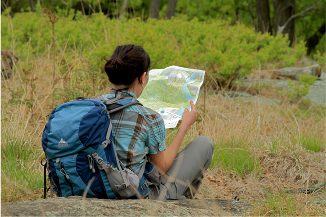
Map - Know where you are and where you are going. Many of our hiking areas feature interconnecting network of trails. Use a waterproof/tear-resistant Tyvek Trail Conference map if available or enclose your map in a Ziplock plastic bag. If you have a mobile device, download Avenza’s free PDF Maps app and grab some GPS-enhanced Trail Conference maps (a backup Tyvek or paper version of the map is good to have just in case your batteries die or you don't have service). Check out some map-reading basics here.
Food - Snacks/lunch will keep you going as you burn energy walking or climbing. Nuts, seeds, and chocolate are favorites on the trail.
Sunscreen and insect repellent
Rain Gear and Extra Clothing - Rain happens. So does cold. Be prepared for changing weather. Avoid cotton--it traps water against your skin and is slow to dry. If you are wearing wet cotton and must return to your starting point, you risk getting chills that may lead to a dangerous hypothermia. Choose synthetic shirts, sweaters and/or vests and dress in layers for easy on and off.
Compass - A simple compass is all you need to orient you and your map to magnetic north.
Light - A flashlight or small, lightweight headlamp will be welcome gear if you find yourself still on the trail when darkness falls. Check the batteries before you start out and have extras in your pack.
First Aid Kit - Keep it simple, compact, and weatherproof. Know how to use the basic components.
Firestarter and Matches - In an emergency, you may need to keep yourself or someone else warm until help arrives. A firestarter (this could be as simple as leftover birthday candles that are kept inside a waterproof container) and matches (again, make sure to keep them in a waterproof container) could save a life.
Knife or Multi-tool - You may need to cut a piece of moleskin to put over a blister, repair a piece of broken equipment, or solve some other unexpected problem.
Emergency Numbers - Know the emergency numbers for the area you're going to and realize that in many locations--especially mountainous ones, your phone will not get reception.
Common Sense - Pay attention to your environment, your energy, and the condition of your companions. Has the weather turned rainy? Is daylight fading? Did you drink all your water? Did your companion fail to bring rain gear? Are you getting tired? Keep in mind that until you turn around you are (typically) only half-way to completing your hike--you must still get back to where you started from! (Exceptions are loop hikes.)
Check the weather forecast before you head out. Know the rules and regulations of the area.
The Leave No Trace Seven Principles
Plan Ahead and Prepare
- Know the regulations and special concerns for the area you'll visit.
- Prepare for extreme weather, hazards, and emergencies.
- Schedule your trip to avoid times of high use.
- Visit in small groups when possible. Consider splitting larger groups into smaller groups.
- Repackage food to minimize waste.
- Use a map and compass to eliminate the use of marking paint, rock cairns or flagging.
Travel and Camp on Durable Surfaces
- Durable surfaces include established trails and campsites, rock, gravel, dry grasses or snow.
- Protect riparian areas by camping at least 200 feet from lakes and streams.
- Good campsites are found, not made. Altering a site is not necessary.
- In popular areas:
- Concentrate use on existing trails and campsites.
- Walk single file in the middle of the trail, even when wet or muddy.
- Keep campsites small. Focus activity in areas where vegetation is absent.
- In pristine areas:
- Disperse use to prevent the creation of campsites and trails.
- Avoid places where impacts are just beginning.
- Pack it in, pack it out. Inspect your campsite and rest areas for trash or spilled foods. Pack out all trash, leftover food and litter.
- Deposit solid human waste in catholes dug 6 to 8 inches deep, at least 200 feet from water, camp and trails. Cover and disguise the cathole when finished.
- Pack out toilet paper and hygiene products.
- To wash yourself or your dishes, carry water 200 feet away from streams or lakes and use small amounts of biodegradable soap. Scatter strained dishwater.
- Preserve the past: examine, but do not touch cultural or historic structures and artifacts.
- Leave rocks, plants and other natural objects as you find them.
- Avoid introducing or transporting non-native species.
- Do not build structures, furniture, or dig trenches.
- Campfires can cause lasting impacts to the backcountry. Use a lightweight stove for cooking and enjoy a candle lantern for light.
- Where fires are permitted, use established fire rings, fire pans, or mound fires.
- Keep fires small. Only use sticks from the ground that can be broken by hand.
- Burn all wood and coals to ash, put out campfires completely, then scatter cool ashes.
- Observe wildlife from a distance. Do not follow or approach them.
- Never feed animals. Feeding wildlife damages their health, alters natural behaviors, and exposes them to predators and other dangers.
- Protect wildlife and your food by storing rations and trash securely.
- Control pets at all times, or leave them at home.
- Avoid wildlife during sensitive times: mating, nesting, raising young, or winter.
Be Considerate of Other Visitors
- Respect other visitors and protect the quality of their experience.
- Be courteous. Yield to other users on the trail.
- Step to the downhill side of the trail when encountering pack stock.
- Take breaks and camp away from trails and other visitors.
- Let nature's sounds prevail. Avoid loud voices and noises.
The Trail Conference is a 2015 Leave No Trace partner.
(c) Leave No Trace Center for Outdoor Ethics: www.LNT.org.
Directions to Trailhead :
To reach Oceanville, take the Garden State Parkway to Exit 48, and proceed south for six miles on US 9 to Oceanville. At the traffic light, where a sign indicates the refuge entrance to the left, turn left onto Great Creek Road and follow it for one mile to the entrance, headquarters, and parking. GPS Coordinates: 39.464712, -74.449856 [800 Great Creek Rd, Galloway, NJ 08205]
For Holgate beach, take NJ 72 east to the town of Ship Bottom on Long Beach Island, turn right, and continue south for eight miles to the dead end where there is parking and access to the beach edge [open only from September 1 until March 31]. GPS Coordinates: 39.531234, -74.263097 [5601-5699 S Long Beach Blvd, Long Beach Township, NJ 08008]
 Support the trails with a donation!